
Blog Post
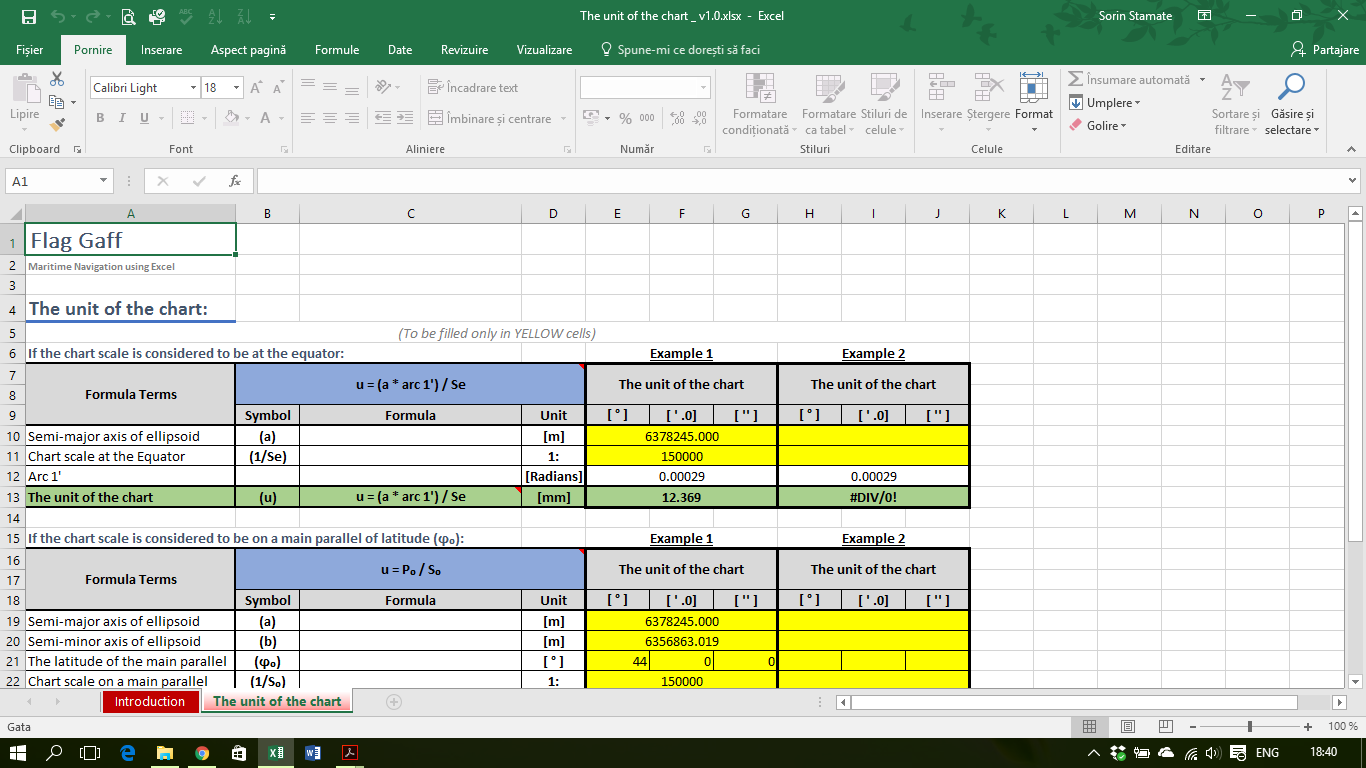
The unit of the chart.
The unit of the chart is the length of an equatorial mile expressed in millimetres. The basic element used to build a map in Mercator projection is the unit-of-the-chart. (more…)
Rhumb line in the Mercator projection
The Mercator projection is a plane conformal projection and is not perspective.
This projection is the most often use in navigation. (more…)

The variation of the chart scale in the Mercator projection
In the Mercator projection, the chart scale varies, increasing proportionally with (sec ϕ) from the Equator to the poles. (more…)

Difference of Meridional Parts or Meridional Difference.
The Difference of meridional parts or Meridional difference (Δϕc): It’s the distance measured on the meridian between two parallels of a Mercator projection. Or, the difference between the meridional parts of any two given parallels. (more…)
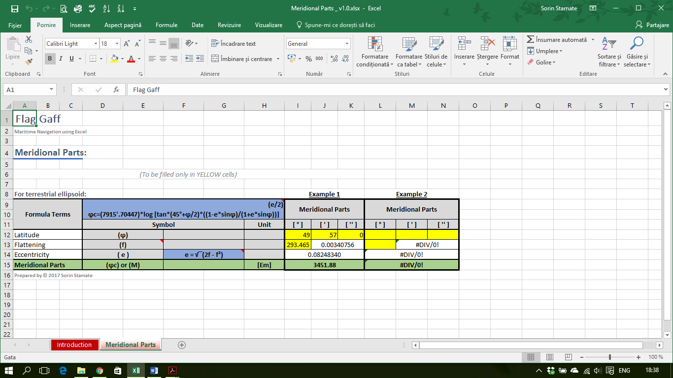
Meridional Parts
Meridional Parts (or Increased Latitude): It is the length of the arc of meridian in the Mercator projection, comprised between the Equator and the considered latitude and expressed in minutes of Equator. Noted with (ϕc) or (M). (more…)